Spring Has Sprung – Avalanche and Flood Danger
The heavy wet snow, while great for skiing, has created a high avalanche danger, and the potential for flooding.
According to the Gallatin National Forest Avalanche Center, the avalanche problem is simple: lots of new snow and wind-loading is adding stress to a weak snowpack. Triggering an avalanche is likely today and the avalanche danger is rated HIGH on wind-loaded slopes steeper than 35 degrees and CONSIDERABLE on all others.
Get the latest avalanche warnings.
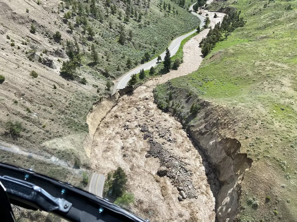
As far as the danger for flooding, temperatures are expected to near 60 by Thursday.
- Water levels in Bozeman (Sourdough) Creek, Rocky Creek, Bridger Creek and the East Gallatin River are all high and are expected to increase over the next several weeks.
- Large streams are not expected to peak until mid-June.
- Beware of rapidly rising and fast moving water in all irrigation ditches, swales, creeks, streams, and rivers. Some historical areas of concern are shown on the attached map or go to http://www.bozeman.net for a larger version.
- Groundwater will rise rapidly with rains and runoff. Inspect crawl spaces and basements often. Ensure sump pumps are in good working condition.
- Citizens are responsible to protect their own property. Sand Bags are available for purchase at several local hardware stores. Please see below (Safety Practices).
- Keep children and pets away from all moving water sources. This is especially important in and around parks and playgrounds. If you see children around moving water, call 911 immediately!
- Most homeowners insurance does not cover flooding. Flood insurance can be purchased but must be purchased 30 days prior to flooding. Go to www.floodsmart.gov for more information.
- If you observe hazardous conditions developing, call 911.
Source: City Of Bozeman
More From 100.7 KXLB